Lloyd Creek area on mainland from pictograph gallery on East Redonda Island, photo: Aurora Scala, 2015.
In response to the B.C. Government’s approval of an application by Lehigh Materials Co., Ltd., to test drill for a gravel quarry at Lloyd Creek in Desolation Sound, I visited the site and its surrounding territory. Although I know Desolation Sound, Homfray Channel and the Prideaux Haven Marine Park well as I have lived and worked in this territory for 44 years, I decided to tabulate what specific landscape and First Nations historical elements might be impacted by the Lloyd Creek testing and by the possible opening of a quarry around its watershed.
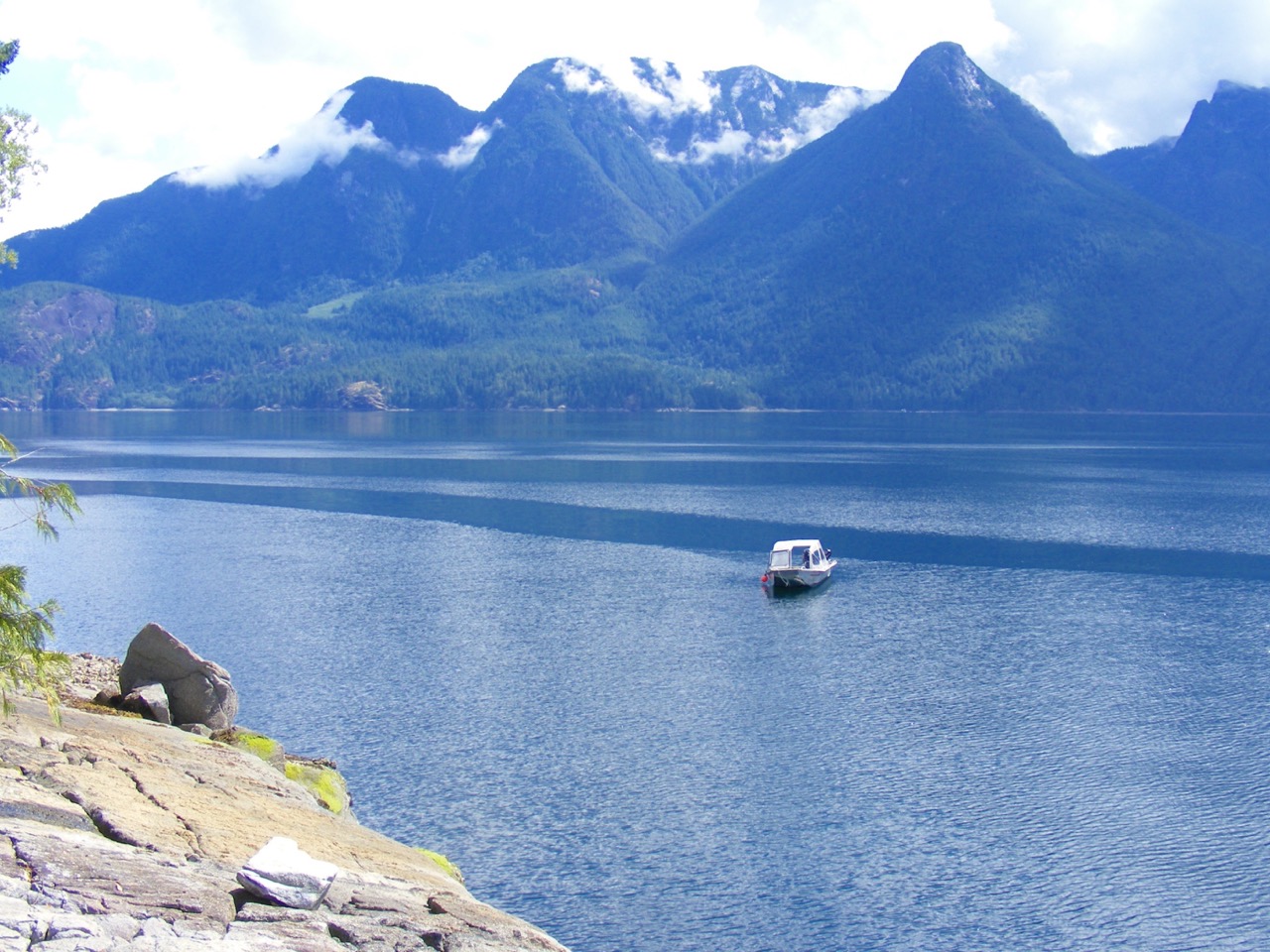
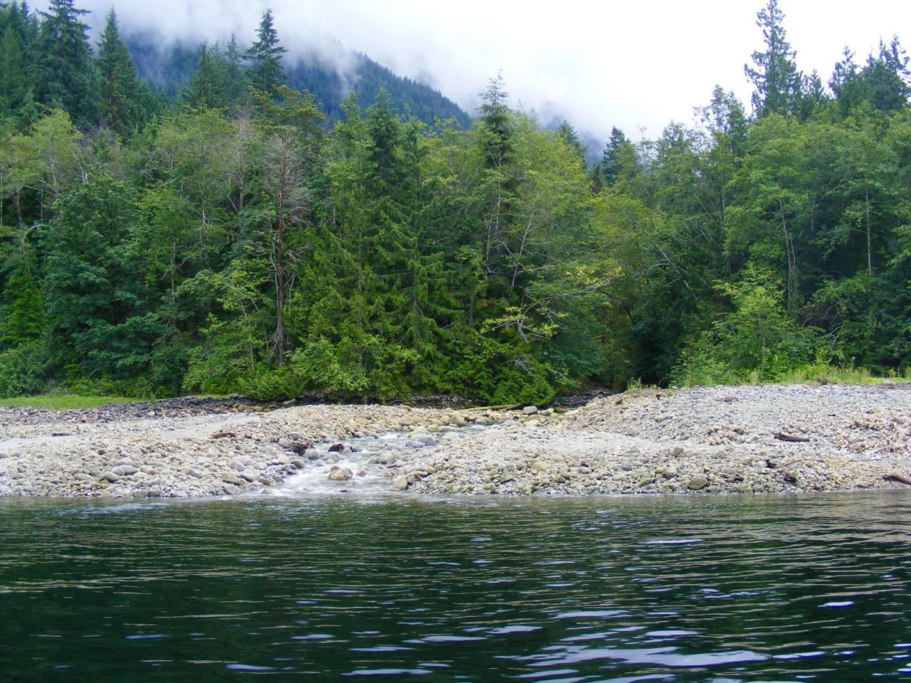
After a bumpy crossing from Cortes Bay on Cortes Island to Desolation Sound on a windy July 4th, 2016 I met Bill Sinclair and Save Desolation Sound Society members at Lloyd Creek Bay. Our first task was to take advantage of 0.6 meter tide at 11:30, a.m., to examine clam beds within rock outcrops on the outer west side of Lloyd Creek Bay opposite Lloyd Creek. The intention was to look for any degree of beach modification by indigenous people of this area to create cultivated clam stations or clam gardens. The bay has three distinct clam-bearing pockets that might be useful in this otherwise very deep channel. It is important to note that Snout Point is only clam garden in Toba Inlet so this bay is the kind of place Klahoose people would stop for clams enroute seasonal village sites in their southern and western territory. What I proposed in Clam Gardens: Aboriginal Mariculture On Canada’s West Coast[i] as a food complex, running from Forbes Bay north through Prideaux Haven, to Tenedos Bay and across Portage Cove to Theodosia Inlet, seems to be an interface area used by the Klahoose and Sliammon peoples. The following Lloyd Creek Bay clam sites are fairly well protected by natural rock arms not exposed at this day’s tide.
Clam Garden area from mainland Lloyd Creek Bay looking south across Desolation Sound
- a) In an inner horseshoe-shaped bay, rocks have been moved to the side and up beach to expose a cleared area in behind two tidal islets in a way common here. Rocks and boulders create currents that increase nutrients for filter feeders. An incomplete pier of blasted rock was begun here by a previous property owner but was halted by some government authority.
- b) A natural rock barrier further south encloses another beach. Red-billed Oyster Catchers nest there.
- c) South is a small, more exposed beach. It is berm-ed up seaward to prevent erosion and has a flat clam bed. There were signs of a recent, un-backfilled, clam dig and a rock fire-pit.
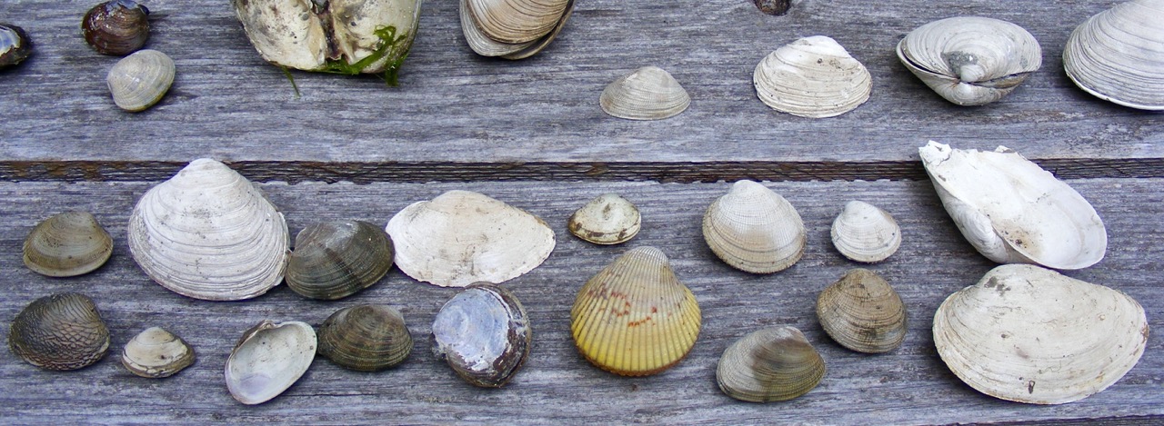
Shellfish varieties, Lloyd Creek Bay
The following clams were collected, identified and photographed: Native Little necks, Bent nose, Manila, and Mahogany. Normal sized, empty Butter clam shells were found although our dig was not deep. A zero or minus tide might produce more Butters. There are Cockles. The shellfish were well plumped out but not abundant. Pacific oysters have colonized the clam beds. The area is well defended by natural offshore rocks and looks groomed. If cultivated, it might be more productive as clam gardens go fallow when not used. This bay is a natural kayak stop with easy access, gravel-filtered fresh water
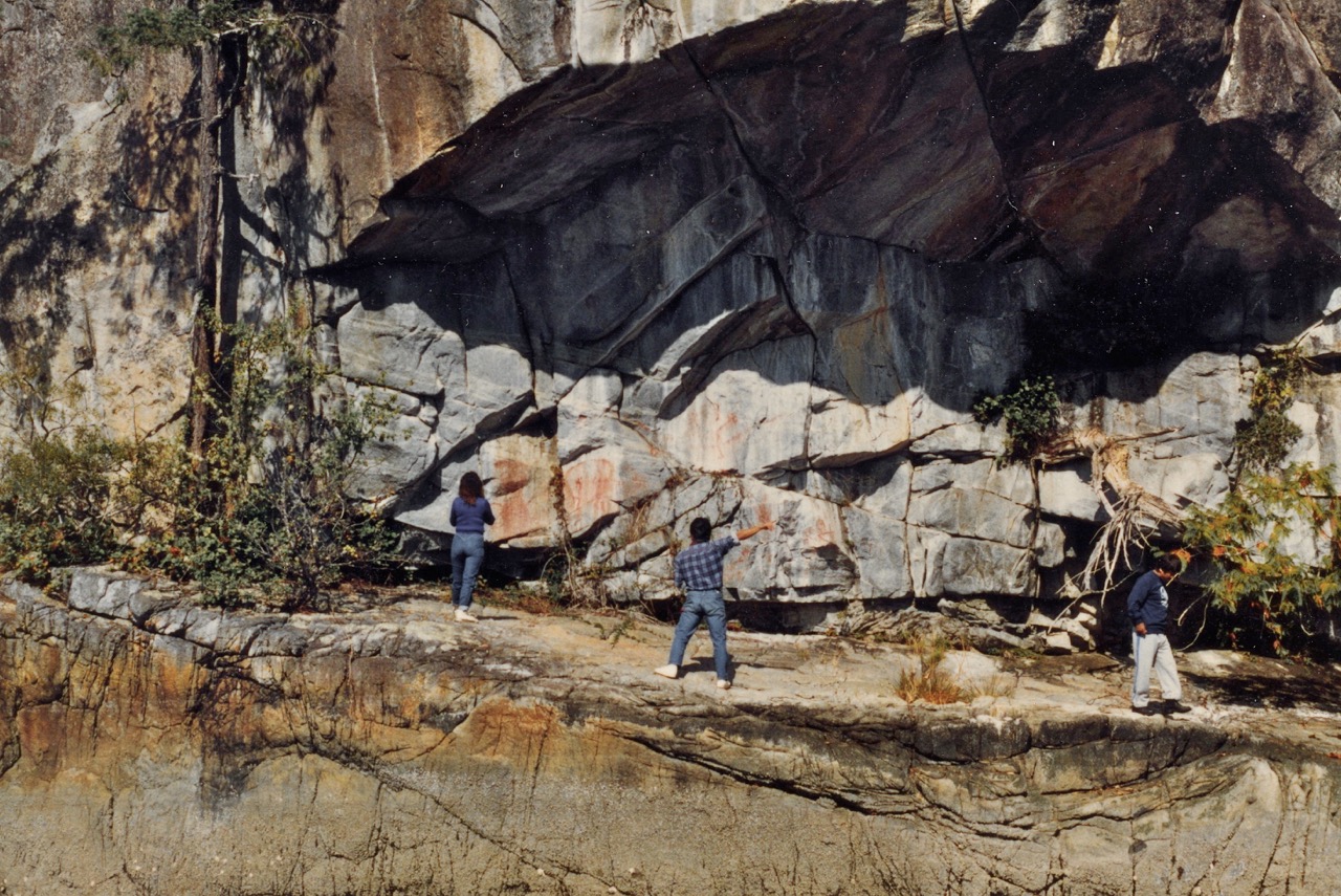
Pictograph gallery, East Redonda Island, Homfray Channnel across from Lloyd Creek. Sliammon Chief Roy Francis center, Klahoose Chief Danny Louie right. 1988.
The SDS group then went directly across Homfray Channel to the Rock Art gallery on East Redonda Island. (Bordon # Eb-Sd-3, lat. SO degrees 11.652N, Long 123 degrees 39.585 W) This is one of two extensive pictograph sites in Homfray Channel and the best protected by a grand, stable overhang. The paint is well fixed by mineral runoff and a fragment was examined at my request by Conservation Canada in the late 1990s.[ii] There is no discernable paint binder and the age of the paintings is undetermined. The most notable figure is an exuberant man with outstretched arms riding what Klahoose Chief Danny Louie described to me in 1988 as “the Sea serpent of Homfray Channel.” There is also a vivid, red ocher, life-sized figure of a shaman; men spear-fishing from a canoe, seals and possibly an abstracted hemlock branch, a symbol of those used in spirit quests. A unique palette area was likely used mixing the ocher to create the figures. A “ghost” Agarikon fungus has always perched high in a Fir tree south of the gallery and a buoyant image of a whale is painted just south of it on that shore, a quartered of a mile above a rare piece of private property. A large portion of East Redonda facing Homfray Channel is an ecological preserve.
Lloyd Creek
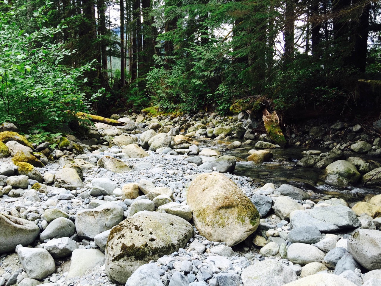
We re-crossed the channel to walk up Lloyd Creek. The creek mouth was rich with plants, wildflowers and trees. Specimens of native Silverweed, Huckleberry, Salmonberry, Salal and Thimbleberry were gathered. Huckleberries were dropped in the creek and a small trout rose to the bait. (Cutthroat?) The gravel boulders were an ankle-breaking, multi-sized assortment of pale rock interspersed in places with silvery-grey sand. A family of Mergansers splashed around where a family of Lesser Canada Geese had paddled to from the creek mouth on a June 19 visit. A creek water sample was taken. The vast alluvial fan of gravel through which the creek runs, and that forms Lloyd Point, would seem to be the tip of the iceberg of gravel that interests Lehigh Material Co. Ltd for a quarry. Since the glacier deposited the gravel, it has been doing an excellent job of filtering water and supporting plant and animal life. Lehigh is owned by Heidelberg Cement Co. of Germany that owns the Sechelt Quarry in partnership with the Sechelt Band.
Lloyd Creek
The party then boated south to the site Archibald Menzies called “Flea Village” in his journal. He was aboard a cutter with a crew mapping the area for Captain George Vancouver in the summer of 1792. [iii]A preemption was held here by Mr. Saulter and Mr. Frank in the 30s. When rock art expert Francis Barrow visited in 1934, their house sat atop what the B.C. Archeology Dept. determines a “First Nations defensive site.” Our troupe climbed the mound and found the graceful Vanilla Plant, used by First Nations to discourage pests, still grew on the flat top. A clam garden fronts the mound and there are recorded canoe slides. Lunch was eaten floating in the bay. The crew then headed further into Prideaux Haven to a southern berm that closes the area and retains an indigenous canoe slide. A blurry pictograph was noted on the east side of Scobell Island. Save Desolation Sound hats and tee shirts were then boated to the Refuge Cove Store, which has offered to sell them to raise money for the Society.
Recent information from the DIEM mapping project states that the timber in the Lloyd Creek drainage consist of at least 50% old growth and mature trees, a unique pocket within a heavily logged-out coast. See attached report and maps below.
Flea Village
Conclusions. 1) Lloyd Creek is part of the upper end of a food complex that ranges from Theodosia Inlet, across Portage Cove (with its own rock art complex), to Tenedos Bay, Prideaux Haven, and up to the Forbes Bay Salmon Run and Homfray Creek near another rock art gallery on the mainland shore. 2) This is an important kayak and boating area that brings a substantial amount of the yearly income flow to the businesses at Lund, Refuge Cove, Squirrel Cove and the Gorge Marina on Cortes Island. 3) Lloyd Creek is said to be a Chum salmon run. Cutthroat as well as Chum run in Unwin lakes above Tenedos Bay and trout would seem to inhabit Lloyd. 4) Counting the pictograph at the entrance to the Theodosia River, there are a total of six rock art sites within this area. The gallery on East Redonda could be damaged by vibration and dust from an industrial site. 4) The presence of a rare old growth or mature tree stand that might be cleared to open a quarry is a travesty.
Suggestions
- An independent, qualified ecologist be hired to access the forest extent, quality and age, shellfish numbers, fish in creek, shellfish growth data (see scallop operation), bear, bird, newt, fish population and water quality. If the forest is as valuable as indicated, a serious effort should be made to make that information public and the stand protected.
- The local fish data is 25 years old. A qualified person should walk Lloyd Creek now and in the fall. Efforts should be made to protest any fall drilling as Chum tend to run in October. The Desolation Sound Salmon Enhancement Society in conjunction with the Save Desolation Sound Society and a project begun with the Pacific Salmon Society on Lloyd Creek to enhance the stocks.
- Archeologists and/or anthropologists, with the cooperation and advice of the Klahoose and Sliammon bands, should undertake a rock art survey. Archeology records are sparse.
Present: Bill Sinclair, Director, Save Desolation Sound
Judith M. Williams, author and artist
Corinne Impey, Director, Six Words Communication
Kevin Fairley, pilot and Member of Save Desolation Sound
Arabella Campbell, artist
Absent: Russell Hollingsworth, Director, Save Desolation Sound
Additional DIEM Data – www.diemproject.org
DIEM initially created maps that showed a higher % of old forest, but then discovered that provincial database for the Lloyd Creek watershed is missing some forest age class data. This deficiency in the provincial database led to an initial skewed outcome. We have since acquired the missing data and this is the new map. You can see that the Lloyd Creek watershed is mostly intact (very few roads, including logging roads) and it is over 50% Old Forest. There is no Sensitive Ecosystem Inventory (SEI) mapping for Lloyd Creek; however, Old Forest is an SEI “sensitive ecosystem” and the Lloyd Creek watershed has a relatively high proportion of it. Much of the Old Forest that is accessible in our area is old because it exists on steep, rocky land, and although it is old, it may not have the forest characteristics that we think of as old growth. It would be good to walk the area! The mapping can only be approximately accurate, but it seems certain that the Lloyd Creek watershed is relatively accessible, still mostly intact and contains a high proportion of Old Forest ecosystem. This is valuable and something to take care of.
Discovery Islands Ecosystems Mapping (DIEM) Project is here to help supply info for a fully informed assessment – and we share concerns about industrial development in this area. Over the past 4 years, DIEM Project has created baseline maps for watersheds in the greater area we call home. DIEM Project’s subsequent (almost) finished Watershed Analysis Project includes watersheds within the Discovery Islands, the Homathko River, and Toba Inlet Watershed Groups – which have now been analyzed for some specific qualities, including how intact they still are; conversely, how fragmented they are, and also how much old forest still exists within them. The Lloyd Creek maps just produced by our GIS specialist, Eve Flager, are the result of DIEM’s data analysis. This is a unique (and appropriate) view because watersheds are natural boundaries. We believe this is how natural areas should be considered when impacts are proposed.
Eve also produced a map of the bigger landscape that illustrates how few mostly-intact watersheds there are in the wider area. (It could be argued that Lloyd Creek’s relatively small size and high degree of intactness should make it a good candidate for protection.) Also a Google Earth map, and although it is difficult to know what’s what, Lloyd Creek looks like a beautifully forested valley.
Lannie Keller (and Eve Flager)
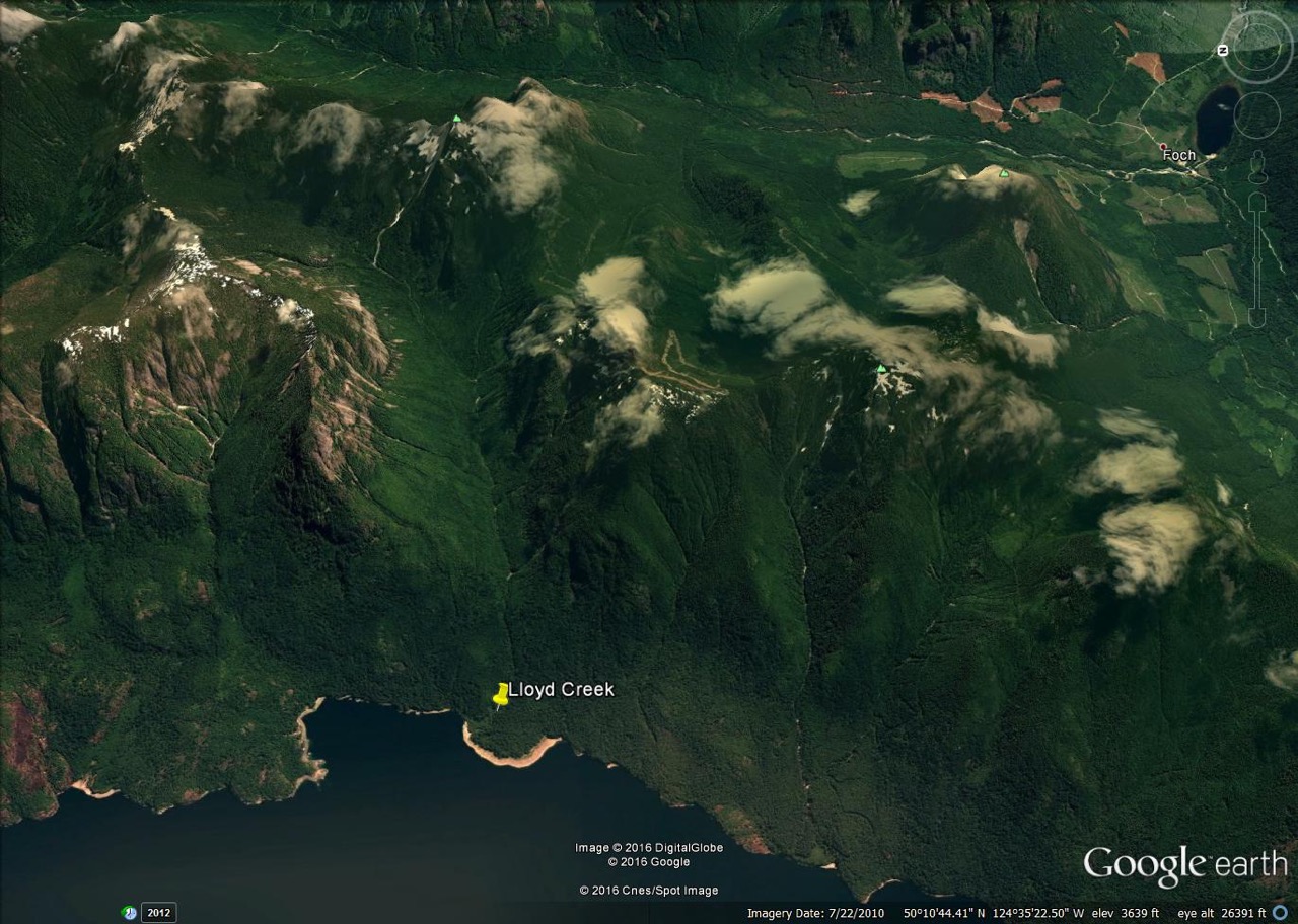
LloydCreek Google Earth view
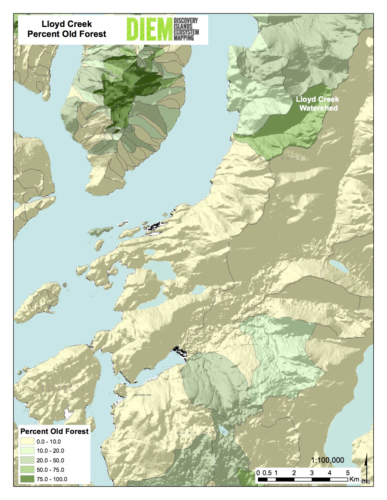
Lloyd Creek Percent OldForest
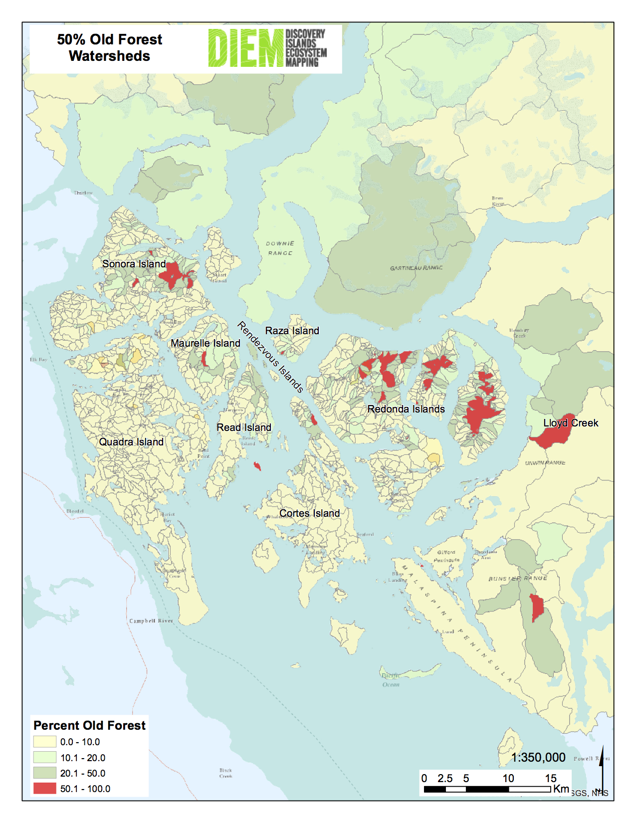
Greater than 50% GT50 Percent Watersheds
[i] Clam Gardens, Aboriginal Mariculture On Canada’s West Coast, New Star Books, 2006.
[ii] See Two Wolves At The Dawn of Time: Kingcome Inlet Pictographs 1893 to 1993, New Star Books, 1996, reprint 2010.
[iii] See previous blog “Flea Village?”
Breathtaking description, thank you.
this is very delicate area we need to taker about this coast, this is a paradise ocean,we need to respect all of this . fragil coast.